
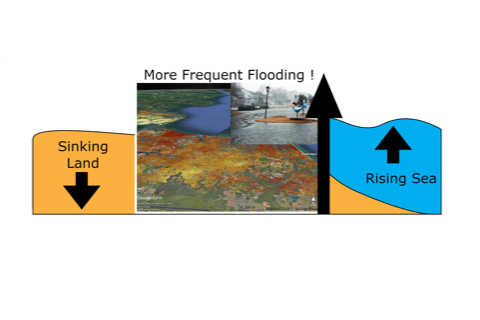
Hampton Roads has experienced a steady and dramatic increase in tidal flooding over the last 90 years due to the combined effects of rising seas and sinking land – a process known as subsidence. In an effort to combat this, the Hampton Roads Sanitation District (HRSD) is injecting treated wastewater into the aquifer beneath Hampton Roads to apply upward pressure on natural land sinkage.
While much work has been done to understand sinking in the region, it has primarily relied on sparsely located GPS measurements. In 2017, a team of researchers from NASA’s Jet Propulsion Laboratory (JPL) and Old Dominion University employed a state-of-the-art methodology that relies on radar satellites to measure the motion of the land surface with millimeter-scale accuracy. They discovered that land motion was not constant over the region. It could vary drastically over a few miles. However, the satellite data was only available between 2007-2011 and required many hours of manual processing.
Now, using current images from the European Sentinel-1 satellite that takes a snapshot of Hampton Roads every 12 days, the team has developed the capability for ongoing monitoring of present-day land motion.
The research team leveraged the joint JPL-Caltech Advanced Rapid Imaging and Analysis Project to pre-process the immense amount of raw satellite data, which then allowed them to rapidly populate the products into a sophisticated algorithm. The study found that Norfolk and Virginia Beach are sinking at greater than 3.5 millimeters per year, with substantial local variability and particular hotspots.
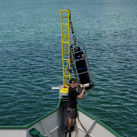
Brett Buzzanga, a doctoral student in Old Dominion’s Center for Coastal Physical Oceanography, completed much of the work during a summer internship at JPL with radar scientist David Bekaert. He is the lead author of a paper published in the influential journal Geophysical Research Letters. In addition to Bekaert, Ben Hamlington, a former ODU professor now at the JPL, and Simran Sangha of UCLA co-authored the article.
“In addition to substantially improving our previous findings, we developed a method that enables evaluation of strategies addressing sea-level rise and flooding in Hampton Roads,” Buzzanga said
The Commonwealth Center for Recurrent Flooding Resiliency (CCRFR), which helped fund the study, was excited about the results and their applicability for ongoing monitoring.
“Localities in Hampton Roads are on the leading edge of planning for relative sea-level rise and flooding,” said Emily Steinhilber, research assistant professor with the CCRFR. “The revised land-motion maps and plans for ongoing monitoring done by the ODU and NASA JPL will further enable local planners to understand how these processes impact flood risk in Virginia.”
"Sentinel-1 satellite observations have allowed us to make great strides in accurately measuring how the land sinks. With an upcoming joint mission between NASA and India's Space Research Organization, called NISAR, we will be able to further complement this and map even more challenging regions," said Bekaert, who is on the NISAR science team.
This information will be of particular use as the wastewater-injection effort accelerates, providing evidence of whether these mitigation efforts are working. More broadly, the study showcases the importance of considering sinking in preparing for increasing flood risks in the future for the rest of the country, led by collaborative research and public policy centers such as the CCRFR.
The research has been published in the AGU Geophysical Research Letters journal.