By Sherry DiBari
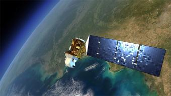
Old Dominion University, in collaboration with George Mason University, Virginia Tech and the University of Virginia, is creating an open-source data platform to integrate space-based satellite data with information collected from airborne, maritime and ground-based systems.
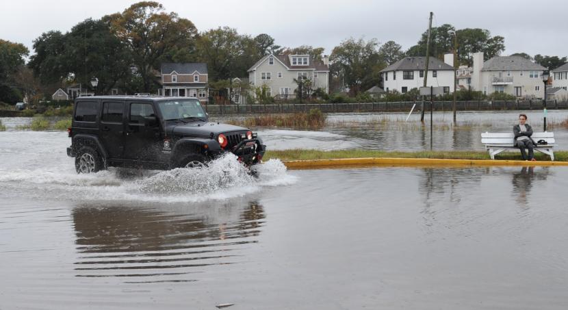
This information could help researchers monitor data for a host of issues, including flooding, wildfire prevention and response, pollution, transportation and power grid efficiency.
The Space Initiative, which stemmed from the 2019 MITRE University Innovation Exchange (UIX), a partnership that includes nine Virginia universities, the Virginia Space Grant Consortium and NASA, was created to address several issues, including environmental security, coastal resilience and transportation system efficiency.
This summer, the group held a series of workshops to address potential applications for the data by bringing university researchers, practitioners and problem-owners together. Topics included river health monitoring, flooding prediction and response, wildfire prevention and response, and transportation and power-grid efficiency.
"With the explosion of new and existing data sources from both space and Earth-based systems, we need a platform like this to bring the data together, turn it into useful information, then connecting problem owners and solution providers across the commonwealth," said David Bowles, executive director of the Virginia Institute for Spaceflight and Autonomy (VISA) and ODU lead for the Space Initiative working group.
The ODU team includes Tom Allen, professor of geography, and Emily Steinhilber, research assistant professor and ODU coordinator for the Commonwealth Center for Recurrent Flooding Resiliency.
Allen and Steinhilber's roles include engaging researchers and end-users who can benefit from the development of a "data cube" framework, a part of the Virginia Small Satellite Data Consortium, funded by the state.
They are focused on helping translate and integrate emerging technology developments for application to coastal flooding, coastal resiliency and flooding prediction and response.
Potential applications for the diverse array of satellite data, sensors and the Internet of Things (IoT) are nearly infinite. However, the university teams are already seeing rapid technology development transition to real-world problem solutions, such as "transportation and disaster management, long-term climate and environmental planning, human health exposure such as extreme heat and air quality, wildfire behavior, and river and water quality," Allen said. "We are seeing that convergence of location-based data allows us to tackle multiple problems and, gradually, maturation of such technology is finding implementation into the workforce and operational needs in all kinds of sectors related to resilience."
"This project is vitally important," Bowles said. "It's laying the foundation, through the data cube construct, for addressing real problems that all of us have to deal with."