

While sitting on a National Aeronautics and Space Administration (NASA) Teams call from his office at Old Dominion University, Tom Allen, Ph.D., professor and chair in the Department of Political Science and Geography, unexpectedly found himself putting experimental research to the test.
As National Weather Service alerts lit up his phone, Dr. Allen — who serves as principal investigator of the NASA Coastal Zone Digital Twin — prompted the team's artificial intelligence (AI)-powered virtual model to pull live weather alerts and radar directly from trusted sources, displaying them on an interactive map almost instantaneously.
The “digital twin” technology helps researchers predict how a real place may respond to storms and rising seas utilizing satellite observations, forecasts and tide and flood sensors. At Old Dominion University, investments in AI, geospatial technology (GIS) and high-performance computing (HPC) through Forward-Focused Digital Transformation are providing the technological foundation needed to advance this work on an even larger scale.
Though this particular technology is still experimental, it will help forecasters, hydrologists, engineers, urban planners and professionally trained emergency managers provide decision-makers with a clearer picture of what is happening — and what could happen next.
The unexpected trial demonstrated the potential of two complementary NASA-funded Old Dominion University projects totaling $2.4 million. Together, they combine satellite observations, AI and neighborhood-scale modeling to help communities prepare for flooding, rising seas and other hazards.
"It is promising to me that we will be able to combine our models and do what-if analyses and forecasts in the future," Dr. Allen said.
Building an AI Ecosystem
Now entering its fourth year, one project is expanding from its original focus on the Chesapeake Bay to the entire U.S. East Coast. Launched in 2022 with $1.4 million in NASA funding, the effort began by building a digital twin.
The project led by Old Dominion University researchers includes collaboration from NASA's Goddard Space Flight Center, Jet Propulsion Laboratory and Langley Research Center, along with National Oceanic and Atmospheric Administration and the French Space Agency.
The newest phase utilizes AI and large language models (LLMs) to organize those data streams into practical decision-support tools. Researchers are building an ecosystem of interconnected digital twins that allows separate datasets to work together, helping users quickly access trusted information during and after severe weather. Users will be able to chat and prompt the digital twin to analyze data, create maps, visualize potential impacts and ask “what-if” questions in case of alternative decisions or situations.
Faster AI and machine-learning computation could also allow the system to show impacts on a much finer scale, down to individual streets, while allowing users to explore “what-if” scenarios. If a storm speeds up, veers west or arrives at high tide, users could adjust variables in the digital twin and quickly see how the potential impacts change. The system can also replicate what-if questions around potential future hazards, such as sea level rise.
Bringing High-Tech Data to Neighborhood Streets
While the digital twin provides broad regional forecasting and analysis, a second NASA-funded project focuses on translating those insights into neighborhood-level decisions.
Supported by a three-year, $1 million NASA Earth Action grant, the second project combines flood modeling with socioeconomic data to help communities identify where flooding poses the greatest risks to public health and critical infrastructure.
This past spring, researchers from Old Dominion University, NASA, the Virginia Institute of Marine Science at William & Mary and Hampton Roads local governments began modeling flood scenarios to better understand how communities are affected before, during and after major storms.
George McLeod, Ph.D., director of Old Dominion University’s Center for Geospatial Science, Education and Analytics (GeoSEA), is the principal investigator on this project and said the work has always been about more than floodwater. Dr. McLeod is also the PI of the Hampton Roads Coastal Resilience Project.
"Since day one, we have talked about this almost as a health project," Dr. McLeod said.
"The hope is to hand off the work to public health and government officials to do targeted interventions."
Looking Ahead
In the long term, the digital twin could incorporate NASA data on sea-level rise and land subsidence to explore how the region may change. Researchers could ask what areas might flood, how marshes could migrate or how long a proposed seawall might protect an area — and whether it could create unintended impacts elsewhere.
Drs. Allen and McLeod will present their work during later this month during a workshop at NASA Langley Research Center marking the 10-year anniversary of Hurricane Matthew's impact on Hampton Roads. Participants will examine how a similar storm could impact the region under projected 2050 sea levels, helping emergency managers evaluate recovery strategies before future disasters occur.
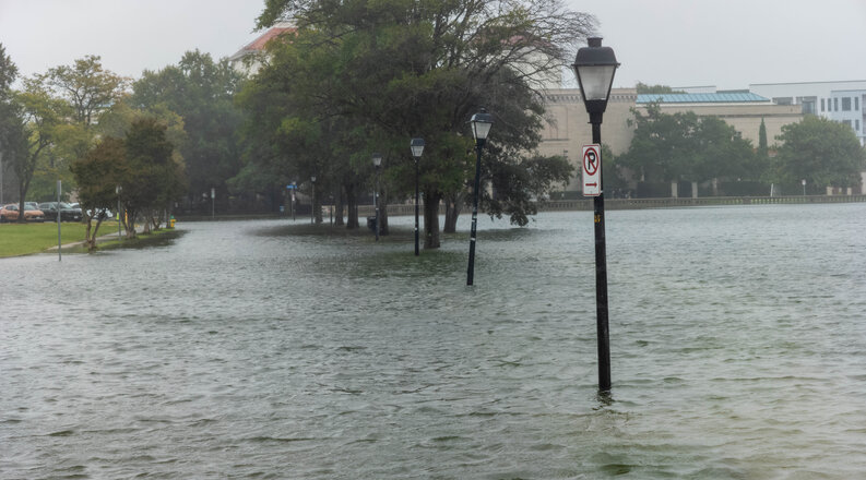
For Dr. Allen, the August 4 flooding underscored why that work matters.
The team is building realistic scenarios that show how different flooding events could affect East Coast communities — from river flooding and coastal storms to the compounding impacts of back-to-back storms and rising seas.
The work helps turn NASA’s Earth-observation science into practical tools that can protect homes and critical infrastructure in Coastal Virginia and be adapted for other coastal regions facing similar threats.