
ODU Researcher: Hampton Roads a Poster-child for Sea Level Rise Threat
September 07, 2017
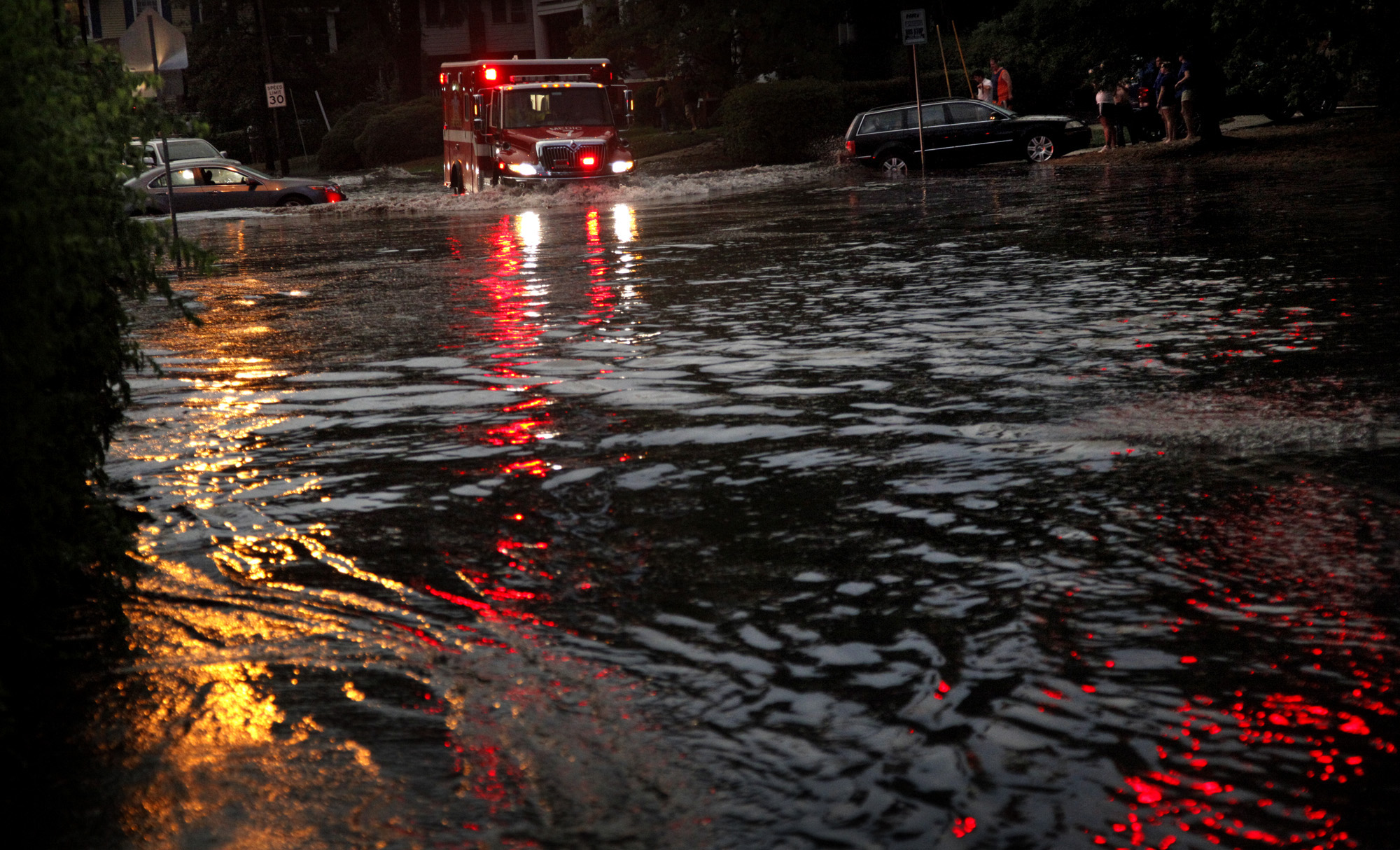 Storm surges of today reach a higher level than in the past simply because they start from a higher level.
 Ben Hamlington
Following the devastation caused by Hurricane Harvey, there has been much discussion on the relationship between global warming and the occurrence of such large and destructive storms, and what it means for our future.
As a coastal community located along a well-worn pathway of past storms, it is natural for residents of Hampton Roads to ask: "Could it happen to us?"
With the approach of Hurricane Irma and its potential impact on southeastern Virginia, and another storm (Jose) in the open Atlantic just upgraded to a hurricane, that question now has a greater sense of urgency.
While there is sound scientific reason to link the warmer climate to the occurrence of more intense storms, there is a similarity in the situation along the Gulf Coast of Texas and in Hampton Roads that serves to exacerbate the impact of impending hurricanes, said Ben Hamlington, and Old Dominion University assistant professor of ocean, earth and atmospheric sciences, and NASA Sea Level Change Team Leader.
Both locations have experienced exceptionally high rates of relative sea level rise over the past century. Relative sea level rise results from the combination of rising seas and sinking land.
Since 1927, the tide gauge at Sewell's Point has measured a rate of 1.52 feet/century, roughly triple the global rate of rise over the same time period, Hamlington said.
"As the oceans warm and ice melts, sea levels do not rise like a bathtub with some areas of the world's coastlines experiencing rates higher than the average," he said. "Shorter term natural variability (with timescales on the order of decades) can also contribute to temporarily higher sea levels. Combining this change on the ocean side with significant subsidence in the region, Hampton Roads is a poster-child for the threat of sea level rise in the United States."
Higher sea levels in the region mean storms now have a greater baseline upon which to build. In other words, storm surges of today reach a higher level than in the past simply because they start from a higher level.
According to Hamlington, the largest storm surge recorded at the Sewell's Point tide gauge was associated with the 1933 Chesapeake-Potomac hurricane that inflicted great damage on Hampton Roads. The measured extreme water level was 5.3 feet over mean higher high water (MHHW) and resulted in much of downtown Norfolk being flooded with several feet of water. Due to relative sea level rise between 1933 and 2017, an additional 1.3 feet would be added to these extremes in the event of a similar storm of similar strength occurring today.
"Early indications are that Irma is larger and more powerful than the hurricane that impacted Hampton Roads in 1933," he said. "Even if we dodge a bullet with Irma, conditions will only become more favorable for a large and damaging hurricane to develop and significantly impact our region. The oceans will continue to warm, and sea level rise in the region is projected to accelerate."
Furthermore, Hamlington added, a better understanding is only now emerging of the extent of subsidence in our region, with initial indications showing some areas experiencing significantly higher rates of sinking than previously thought.
All of these factors combine to make Hampton Roads increasingly vulnerable to future storm events.