
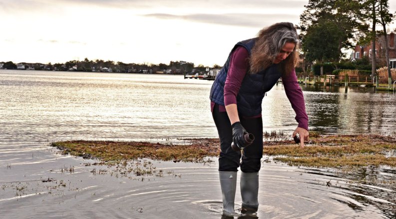
Old Dominion University Ocean & Earth Sciences Professor Margaret Mulholland has studied algal blooms for more than three decades and has seen the devastating effects they can have on waterways, fisheries, aquaculture, tourism and more.
In the fight to improve tracking and potentially slow down algal impacts, Mulholland and ODU Eminent Scholar and Professor Eileen Hofmann were recently awarded a $3 million grant from the National Oceanic and Atmospheric Association (NOAA). The grant supports a five-year project to conduct real-time surveillance and data of harmful algal blooms in the Chesapeake Bay and other major waterways in the Hampton Roads region. The data will be used to build forecasting products for harmful algal blooms in the mid-Atlantic region.
This multimillion-dollar research project was funded by the NOAA Monitoring and Event Response for Harmful Algal Blooms (MERHAB) program and begins Oct. 3, 2023. ODU is the lead institution and Mulholland is the principal investigator. She will work with scientists from the Virginia Institute of Marine Science (VIMS), the NOAA National Centers for Coastal Ocean Science (NCCOS) and the Mid-Atlantic Regional Association Coastal Ocean Observing System (MARACOOS) to conduct research through 2028. A plethora of agency and community partners will work cohesively with Mulholland to detect, monitor and provide better surveillance on threatened waterways.
The partners will use both existing microscopic imaging technologies such as the Imaging FlowCytobot and Flowcam, and emerging technologies such as Planktoscopes to remotely detect harmful algae. PlanktoScope phytoplankton imaging systems will be used in the field and in partner laboratories to enhance data collection and to build image libraries and classifiers using machine learning. Once built, these libraries and classifiers will be used for early and rapid detection of potentially harmful algae in the field and allow a wide array of stakeholders to participate in the detection and monitoring of harmful algal blooms so that managers can take steps to mitigate their impacts on mid-Atlantic coastal resources.
The use of PlanktoScopes will provide improved real time detection and near real-time data products to improve forecasting and advise stakeholders where and when populations of M. polykrikoides and A. monilatum, two prominent bloom-forming algae in the Chesapeake Bay, are likely to impact water quality, aquatic habitats and commercial fisheries operations. These blooms, which Mullholland has been researching for more than 20 years, cause disruptions to wild and farmed seafood production, coastal tourism and recreation and healthy coastal ecosystems.
“This project will significantly augment monitoring and management through coordinated laboratory, field, satellite and modeling studies that will build on our ongoing and previous projects and activities, leverage and expand our existing monitoring/modeling frameworks, incorporate emerging technologies and engage stakeholders in co-development and co-production of approaches,” Mulholland said.
She also said it will result in a massive increase in data collection of harmful algae in the region. Currently, “states don’t have the resources to survey their coastal waters, and satellites only ‘see’ the water’s surface and can’t distinguish harmful from non-harmful algae,” Mulholland said. With the use of image-classifying software and machine learning, Mulholland and her team of expert scientists and partners will be able to identify algae bloom in near real-time.
“Our current models are limited by the lack of consistent long-term measurements that can identify important local controls on harmful algal blooms,” Hofmann said. “The measurements from the expanded observational network developed in this project will provide new insights that will allow us to refine our current models and greatly advance our capability to forecast the occurrence of harmful algal blooms in the Chesapeake Bay.”
Using newly developed technology and enhanced monitoring and surveillance, the early detection of these harmful algal blooms will allow managers and stakeholders to be proactive about mitigation of their negative effects. Citizen scientists will also be trained to observe and report discolored or bioluminescent water and collect water samples. Observations and forecasts will be publicly available through the Chesapeake Bay Environmental Forecasting System and the MARACOOS OceansMap portals, allowing stakeholder groups to avoid bloom-waters and prevent aquaculture losses. According to the 2018 Census of Aquaculture (USDA), Virginia is the largest seafood producer on the east coast of the U.S. and ranks first in the nation for hard clam and eastern oyster production.
“I am excited to see the advances fostered by this new NOAA NCCOS research project, including enhanced monitoring to help minimize harmful algal bloom-related disruptions to Virginia oyster growers and a pilot observing network and forecasting system to help mitigate harmful algal bloom impacts across the Chesapeake Bay Region,” said Marc Suddleson, MERHAB program manager at NOAA National Ocean Service.
Some of the largest stakeholders of this project are citizens living, working and recreating in mid-Atlantic coastal waters and the Chesapeake Bay. Citizen outreach and engagement will be a crucial component of this project. Climate change has resulted in increased tidal flooding and higher water temperatures in the lower bay and these changes are thought to be conducive to larger and longer blooms of potentially harmful algae.
“It has taken 20 years to assemble a robust regional network of experts who have the capacity to implement this project,” Mulholland said.
"Our team of five investigators at the Virginia Institute of Marine Science (VIMS) is excited about this collaboration that will leverage our existing collection efforts in the York River and expand our engagement with local stakeholders,” said Pierre St-Laurent, a senior research scientist at VIMS. He is also excited at the prospect of supplementing the real-time data with the Chesapeake Bay Environmental Forecast System (CBEFS, www.vims.edu/cbefs). This public online resource already provides bay-wide forecasts to local fishermen, and Laurent said extending its predictions will turn it into a critical asset for the whole Chesapeake Bay community.
Here is the full list of partners and collaborators for the grant: