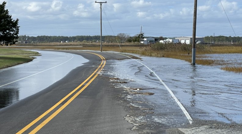
The year’s highest of high tides – the King Tide – laps into the region Oct. 27 to 29, bringing hazards and headaches for Hampton Roads residents as well as golden opportunities for scholars and scientists.
Geographers and Earth science researchers use the occasion to spot trends, refine projections and learn more about the impact of tidal flooding and sea level rise across coastal Virginia.
“This data is critical to the work that we do,” said Nicole Hutton, assistant director of engagement for the Institute for Coastal Adaptation and Resilience (ICAR) at Old Dominion University.
As in years past, ODU’s Blue Line Project will coincide with Catch the King – an effort organized by the Wetlands Watch organization – and another Old Dominion research initiative, Measure the Muck. All three projects share an overarching goal: to gather facts that help the public see the significance of sea level rise.
“Hosting real-world experiences such as the Blue Line events and developing clear visualizations of what happens during a King Tide event are ways we can ensure people of all ages understand why these types of flooding events are an important indicator of future flooding in areas,” said Jennifer Whytlaw, assistant professor of geography at ODU.
Here’s a closer look at these interrelated efforts:
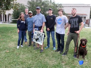
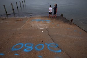
Blue Line Project: This year, the project will focus on one of the region’s most flood-prone communities, Poquoson. Typically, project participants use blue, eco-friendly water-based paint, chalk lines and flags to mark the projected tides in 2040, 2080 and 2100.
In Poquoson on Oct. 28, the Blue Line team will use drone flights to document the high tide and its effects. “We’ll be measuring not only the extent of the tide, but also marine debris that may be washed up with it,” Hutton said.
ODU secured funding from the National Sea Grant Office to work in partnership with the Virginia Department of Environmental Quality to study marine debris. “This debris could have public health impacts,” Hutton said. “It’s important to know what’s out there and how close it’s getting to us and how often.”
Those interested in participating are invited to meet from 8:30 to 10:30 a.m. on Oct. 28 at the Rens Road Public Boat Ramp, 105 Rens Road, Poquoson.
Watch a video from last year’s Blue Line Project at this link.
Catch the King: Residents can join the Wetlands Watch crew and partners Oct. 27 to 29 as they collect flooding data using the “Sea Level Rise” mobile phone app.
“We are continuing record-breaking efforts to map neighborhood flooding during the highest tide of the year,” a flyer announced. Catch the King is a crowdsourced community science event that invites volunteers to help with data collection.
“Tidal flooding is a major environmental, health, and safety issue for coastal communities,” Wetlands Watch says. The organization predicts that Hampton Roads residents could experience nuisance “flood days” for a third of the year by 2050.
Visit wetlandswatch.org/app-faqs to find tutorial guides. Contact Gabi Kinney at gabi.kinney@wetlandswatch.org to learn more about Catch the King.
Measure the Muck: In an activity starting 8:30 a.m. on Oct. 28, volunteers will be trained to use a phone app to map flooding and collect water samples to measure pollutants flowing into the Chesapeake Bay.
Those interested in participating can meet in Room 328 of ODU’s Ocean and Physics Building, 4600 Elkhorn Ave. Volunteers should dress for outdoor activity and bring rain boots if available. The event will provide gloves.
To volunteer, follow these steps:
Read more about Measure the Muck here.