
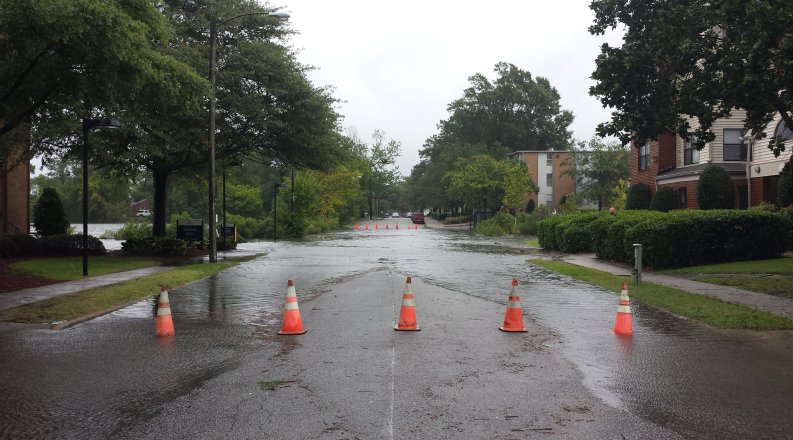
The phrase "nuisance flooding" has become familiar to Hampton Roads residents. An extremely high tide, a storm out at sea or unfortunate timing on a rainstorm can send local commuters to side streets, looking for alternative routes to work or home.
But what happens when nuisance becomes routine? A group of Old Dominion University researchers and student volunteers will use washable blue paint to demonstrate estimates that show tidal flooding becoming much more than a nuisance.
The Blue Line Project is a collaboration between ODU, the City of Norfolk and the National Oceanic and Atmospheric Administration (NOAA), supported by the Commonwealth Center for Recurrent Flooding Resiliency (CCRFR) and the University's Institute for Coastal Adaptation and Resilience (ICAR).
The highest tide of the year, known as a King Tide, is forecast to arrive in the region Oct. 27. In the days before, ODU faculty, staff and student volunteers will use blue eco-friendly water-based paint, chalk lines and flags to show the projected future high tides in 2050, 2080, and 2100 in three Norfolk locations already prone to nuisance flooding - the Chrysler Museum, ODU Sailing Center and Cambridge Crescent in Larchmont.
"These aren't King Tides we are illustrating. These forecasts are for typical high tides 30, 50 and 80 years in the future," said Tom Allen, professor of geography and leader of the climate and sea level rise program of ICAR.
Illustrating an accurate future tidal forecast was a collaborative process.
The City of Norfolk's resilience officers advised which sites to select for the illustration. NOAA's National Geodetic Survey provided topographic surveys to accurately "ground truth" the Blue Line data. And ODU's Center for Geospatial Visualization and Computing provided computer models and drone mapping of shorelines in the affected neighborhoods.
"This extensive use of geospatial technology and the sea level rise scenario developed by the Hampton Roads Coastal Resiliency Working group allow the Blue Line Project to map and portray potential future high tides with a high degree of accuracy and precision," Allen said.
After the students have marked future high tides in the days ahead of the King Tide, the public is welcome to see the blue lines at open spaces in the three locations. On the morning of the King Tide, which is projected to peak at 9 a.m., students and faculty will be at all three sites to discuss the project and answer questions.
A WEBSITE has been created for the Blue Line Project, which will be updated with photos and a story map to illustrate the project.
Established in 2016, the Commonwealth Center for Recurrent Flooding Resiliency engages the expertise, resources, and intellectual vibrancy of William & Mary and Old Dominion University in support of building resilience to rising waters.
The Institute for Coastal Adaptation and Resilience is the national center for science and the practice of coastal resilience at Old Dominion University, launched in 2019 to seek practical solutions to challenges faced by coastal communities.