Display at Perry Library Highlights Researchers’ Study of Regional Vulnerabilities in Wake of Catastrophic Storms
October 25, 2013
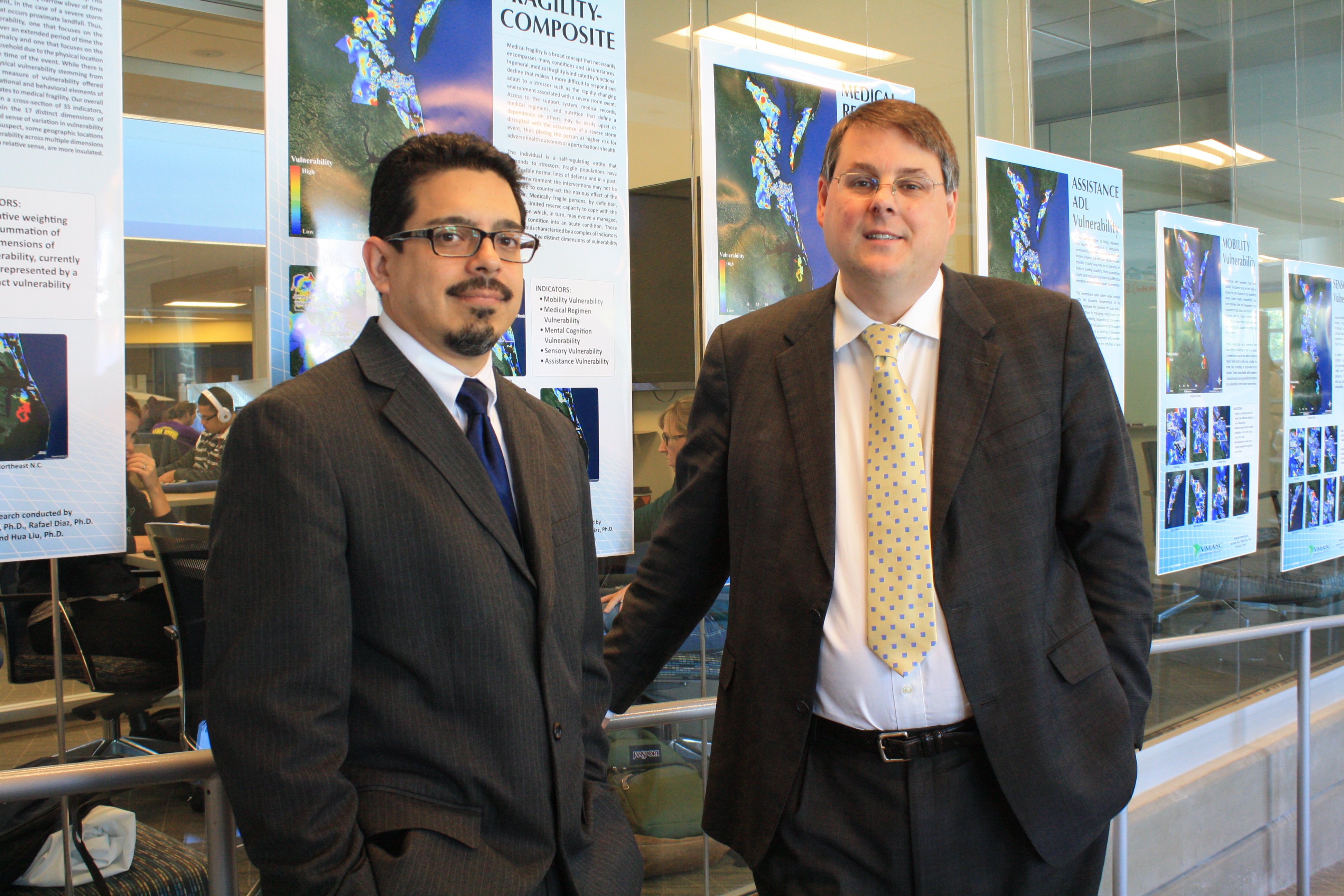
 Rafael Diaz (left) and Joshua Behr
Images of nature's ability to destroy and disrupt communities with storm surge and rising floodwaters are indelible.
Be it swollen rivers in America's Midwest, the complete destruction wrought from the Indian Ocean tsunami or the tragedy of Hurricane Katrina, citizens can recall numerous iconic images and reporting on the destructive nature of high winds and flooding.
However, beyond a general understanding that such events are catastrophic for a region as a whole, and tragic on a personal level, a systematic understanding of how they may impact the well-being of specific populations over the weeks, in the months and years that follow the event is less understood.
Through a comprehensive survey of populations across two-dozen communities in the Hampton Roads region, Old Dominion University modeling and simulation researchers Joshua Behr and Rafael Diaz have been able to paint the first region-wide picture of social vulnerability. Traditionally, vulnerability assessments have focused on the built environment and the region's critical infrastructure. However, the researchers reason that a more realistic understanding of vulnerability must incorporate the interaction between citizens and their built environment.
To this end, the researchers have identified 16 different types of social vulnerability and illustrated variation of these across the region.
Graphic representations of the several different dimensions of vulnerability are on display at ODU's Perry Library now through November.
The maps, located in the library's Learning Commons, "reflect our evolving understanding of vulnerability. The concept of vulnerability is both at once familiar and ambiguous," said Behr, research professor at the university's Virginia Modeling, Analysis and Simulation Center (VMASC).
The idea of conceptually defining different types of social vulnerability, creating and collecting real-world data, and then visually representing the placement of vulnerability across our region was daunting for the VMASC researchers.
"The sociology of humans is complex and so it ought not to be a surprise that defining vulnerability is a challenging undertaking," said Diaz, research professor at VMASC. "In that light, the attempt to conceptualize, let alone specify practical measures, for distinct types of vulnerability is pushing the envelope."
Karen Vaughan, digital services coordinator with the University Libraries, said the display is timed to coincide with the "Transatlantic Solutions to Sea Level Rise Adaptation" EU conference being hosted by ODU Oct. 30-31.
While the VMASC vulnerability research is not a forecast of sea level rise or climate change, it could be useful for those wanting to better understand the potential impact of more frequent or intense severe storm events. "The purpose of the display is to create more campus awareness of the research being conducted across campus as well as specific work being done on climate change and sea level rise issues," Vaughan said.
Karen Eck, director of research development with ODU's Office of Research, said the project by Behr and Diaz to do the comprehensive social vulnerability study of Hampton Roads residents was supported in part by the Perry Family Fund and administered through the Office of Research.
"We are pleased their team has gone on to secure external funding to continue this research that has a direct impact on understanding vulnerability of Hampton Roads' residents and communities when severe weather events occur," Eck said.
The maps are visual representations of vulnerability stemming from existing theory, and guided by discussions with Hampton Roads' households following Hurricane Irene. An added dimension of this research is knowledge that vulnerability is neither equally distributed across society nor spatially even across our geography.
"Particular populations in particular geographies are likely to exhibit multiple vulnerability characteristics. This compounded, or hyper vulnerability, may be especially devastating to a family faced with an impending storm," Diaz said.
The researchers hope that community planners in this region, or in other regions prone to catastrophic flood events, can use this knowledge to understand how financial, perceptual and medical conditions may constrain a family's ability to properly assess, prepare for, weather and recover from a severe storm event.
"While these maps may, in part, help refine and advance our understanding of vulnerability on several levels, these efforts are also part of a broader endeavor to develop tools that provide insight into how various investments, interventions and policy choices made today may condition the social, health and economic impacts of a future severe storm," Behr said.
Currently, the researchers are building system dynamic models used to forecast the longer-term regional well-being, both in terms of health and economics, stemming from various severe storm scenarios.

